|
|
| Site Summary | ||||||||||
|
||||||||||
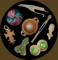
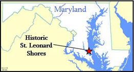
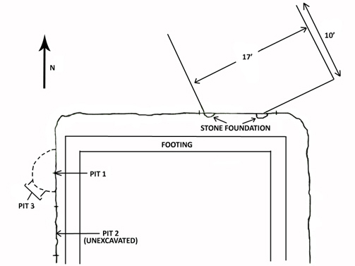
Site History Site 18CV55 was identified by archaeologists in 1980 as a late 17th to early 18th-century occupation within the proposed housing development now known as St. Leonard Shores. Attempts to reconstruct the history of the property were hindered by the loss of Calvert County land records to a fire in the 1880s, though several 17th-century patents can be affiliated with the 602 acres that comprise St. Leonard Shores. These include part of Foxes Road, patented in 1662, Blinkhorne, patented in 1659, Wolf’s Quarter, patented in 1663, Dick’s Cabin, patented in 1672, and part of Smith’s Hogpen, patented in 1694. It has not been possible to map the boundaries of these tracts based on land records, so ownership of the site is uncertain. It is possible that the owner never lived on the property though, since some large landholders rented their property to tenants. Archaeology In 1985 the site was threatened by development, prompting the recordation and salvage excavation of three features exposed by the placement of a new foundation footing. One feature consisted of a ferrous sandstone foundation truncated by the modern builder’s trench. Field notes refer to the area around the foundation as a cellar, but it is not entirely clear whether this is in reference to the modern construction or the nature of the original feature. Additionally, three pit features were exposed. Pit #1 measured about 3.5’ below the surface and was 5.5’ wide. It was somewhat bell-shaped in profile with burned subsoil at its base. This pit was rich in artifacts, yielding tin-glazed ceramics, stoneware, pipe fragments, two iron knives, two leather ornaments, and an abundance of faunal material and architectural debris. The excavation of Pit 1 revealed an earlier feature, designated Pit 3, that had been intruded by Pit 1. This feature was roughly rectangular in profile and contained fewer artifacts. Pit 2 was unexcavated, but it is described as having been 4’7” long and 4’ deep, and it was fairly close to Pits 1 and 3. Although the excavations were far from complete, the salvage efforts indicate that at least one structure was present, and a second structure may be implied by a series of sub-floor pits. Summary by Sara Rivers Cofield References
The Historic St. Leonard Shores archaeological collection is owned by the Maryland Historical Trust and curated by the Maryland Archaeological Conservation Laboratory. |
||||||||||

|

|


 The land slated to become the St. Leonard Shores housing development was surveyed in 1980 and several sites were identified. Among them was 18CV55, a late 17th to early 18th-century site revealed by shovel tests and the excavation of two test units. Shovel tests revealed a brick scatter throughout the plowzone of the site, and one came down onto a large 30’ by 30’ feature. Two test units placed at the edge of the feature demonstrated that it had intact stratigraphy below the plowzone. Artifacts recovered included faunal remains, pipe fragments, nails, brick, and a few ceramics. The feature had sloped sides more indicative of a borrow pit than a cellar, but no further investigation was undertaken to explore the feature during the 1980 survey.